Cyclone Narelle turns Australia’s skies red; dramatic dust storm videos emerge
Cyclone Narelle’s intense winds lifted vast amounts of iron-rich soil into the air.
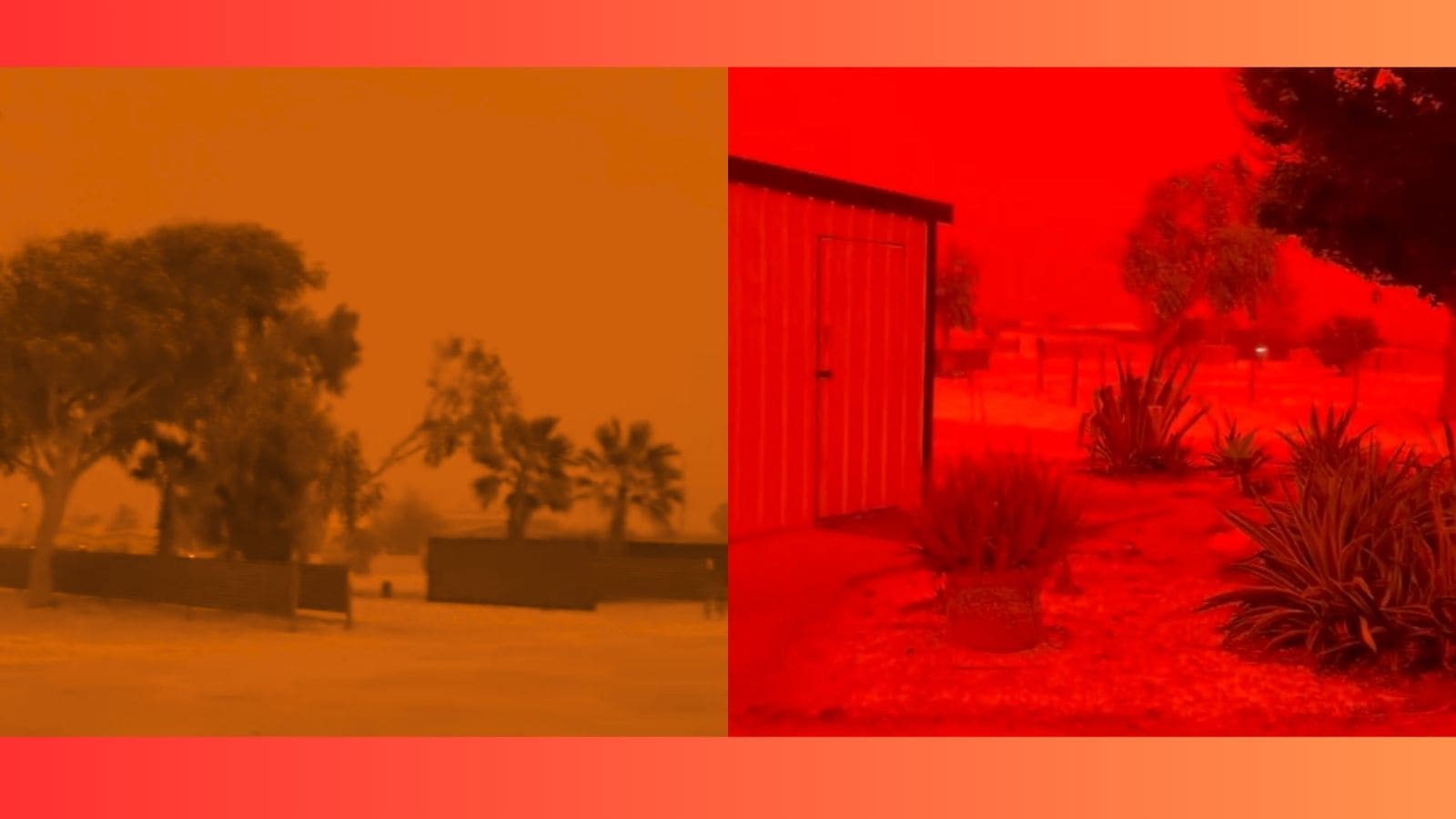
Cyclone Narelle triggered a powerful dust storm, turning the skies over parts of Western Australia a blood red. The apocalyptic scene was captured around Shark Bay and Denham.
According to CNN, the phenomenon was caused by the cyclone’s intense winds lifting vast amounts of iron-rich soil into the air. The TV network added that daylight vanished within minutes, with visibility plunging to near zero as thick dust engulfed the areas.
While the most dramatic scenes were reported in the Gascoyne area, it also affected the Pilbara coast, including Exmouth and Karratha.
Watch here:
🚨🇦🇺 The sky turned blood red across Western Australia as Tropical Cyclone Narelle pushed dust through the air.
Between the meteors and now this, 2026 is giving very biblical vibes and we’re only in March…pic.twitter.com/Fc6jcHmbES https://t.co/OUTQHM5NBl
— Mario Nawfal (@MarioNawfal) March 28, 2026
The video has gone viral, amassing a deluge of reactions. “The sky literally turned blood red… This isn’t just a cyclone. It’s a reminder that nature still holds power we can’t control. 2026 waking us up already. Feels like the opening scene of something much bigger,” an X user wrote. “It’s called red dust storm. Common in Northern parts of Western Australia & areas near desert. Iron in desert oxidises, causing red dust storms,” another user commented.
“Nature keeps reminding us that it can produce visuals more dramatic than any movie and 2026 seems determined to prove that point every single week,” a third user reacted.
Cyclone Narelle is described as a rare “triple-strike” storm. It reportedly first made its landfall on Queensland’s Cape York Peninsula on March 20, tracked across the Northern Territory, then regained strength over the Indian Ocean before hitting Western Australia.
The cyclone reached Category 4 intensity, with wind gusts surpassing 200 km/h. The storm caused significant damage, including roofs being torn off buildings in Exmouth and Coral Bay.
However, by March 29, it weakened to a Category 3, eventually transitioning into a subtropical low, the report added.
Queensland Premier David Crisafulli highlighted the storm’s severity, stating, “In many cases it will be the strongest wind people have experienced in this part of the state for a long, long time.”